Another cyclone may hit the Queensland coast just over three weeks after the same area was smashed by Severe Tropical Cyclone Narelle, the Bureau of Meteorology says.
But a meteorologist warned forecasts predicting the path and strength of Severe Tropical Cyclone Maila remained uncertain, with the storm likely to make landfall over the weekend.
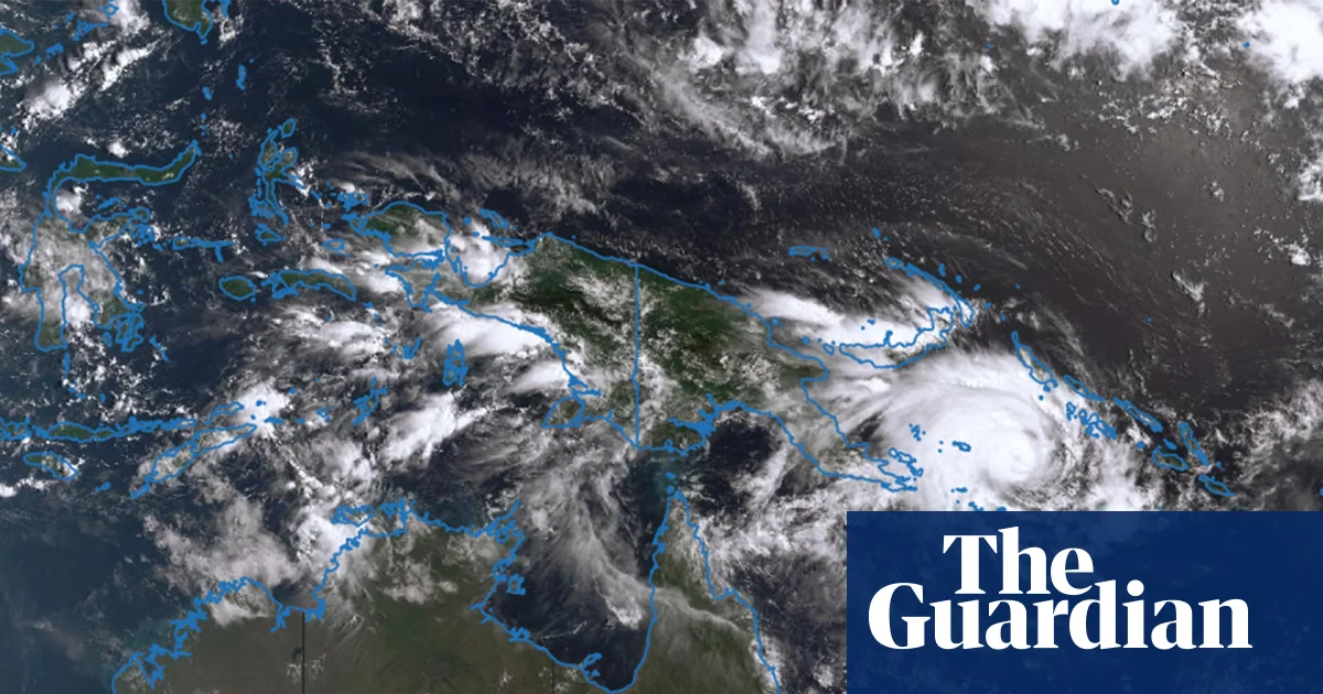
Maila was on Monday morning circling an area of the Solomon Sea about 590 kilometres west of Honiara in Solomon Islands. Classed as a category 3 system, it was producing wind gusts of up to 185 kilometres an hour, with sustained winds of 130 km/hr.
The storm had spent recent days travelling in circles between Papua new Guinea and Solomon Islands, but was expected to turn in a south-westerly direction midweek and head towards the Queensland coast.
The bureau’s Helen Reid said the most likely scenario was that Maila would cross the coast at Cape York at the weekend, but warned it was too early for certainty and that the storm could change direction and head away from the coast.
“It’s still jury’s out on this one, but it does look like it will be heading towards that peninsula coastline over the course of the weekend,” Reid said.
She said Maila had the possibility of hitting the same area affected by Severe Tropical Cyclone Narelle just last month and was most likely to make landfall in Cape York.
It could also swing south and hit more populated areas such as Cairns or Townsville – or miss the coast entirely, she said.
Narelle – this season’s strongest storm so far – made landfall in Cape York on 20 March as a category 4 system and tore a swathe through the remote area.
It made landfall twice more, in the Northern Territory and then Western Australia – the first storm to do so in 21 years.
It was not clear how strong Maila would be when it made landfall, Reid said, but it was expected to strengthen to category 4 and then weaken back to category 3 in coming days.
She said it may cross the coast as a category 4 – severe – cyclone, meaning sustained wind speeds of 160 to 199 km/h.
“We’ll be keeping a very close eye on it, but at this stage, it may well still be another severe tropical cyclone through there,” she said.
Reid said the warm seas that made Narelle so powerful were feeding Maila as well.
“It hasn’t had an opportunity to cool down. Narelle wasn’t that long ago,” she said.
“There’s still plenty of energy in that warm water.”
The last April cyclone to cross Queensland’s coast was Severe Tropical Cyclone Ita, in 2014. It made landfall near Cooktown in far north Queensland.
Source: Read Full Article